Green-Wood Cemetery and Historic Fund staff devotes much of its time and efforts to improving the visitor experience. Programming, maps, exhibitions, apps–we work at making your Green-Wood visit a great one. So, in this spirit, Stacy Locke, our manager of historical collections, and I have been working with Urban Archive, an app of New York City historic places which will allow you to tour Green-Wood’s grounds and see, on your Smartphones, images from our Historic Fund Collections of the very spot where you stand–photographs from 150 years ago!
The idea is a simple one: use the great stereoview images of Green-Wood from our Historic Fund Collections to allow visitors, with the Urban Archive app on their phones, to wander the grounds and have a then-and-now experience. You will be able to walk the grounds at your leisure–and see what the spot where you stand looked like way back 150 years ago. We have sent images and text off to the tech staff at Urban Archive; they will be cropping the photos down to a single image and adding the text we have provided to inform visitors as to what they are seeing. This will be an exciting new way for you to enjoy, and explore, Green-Wood!
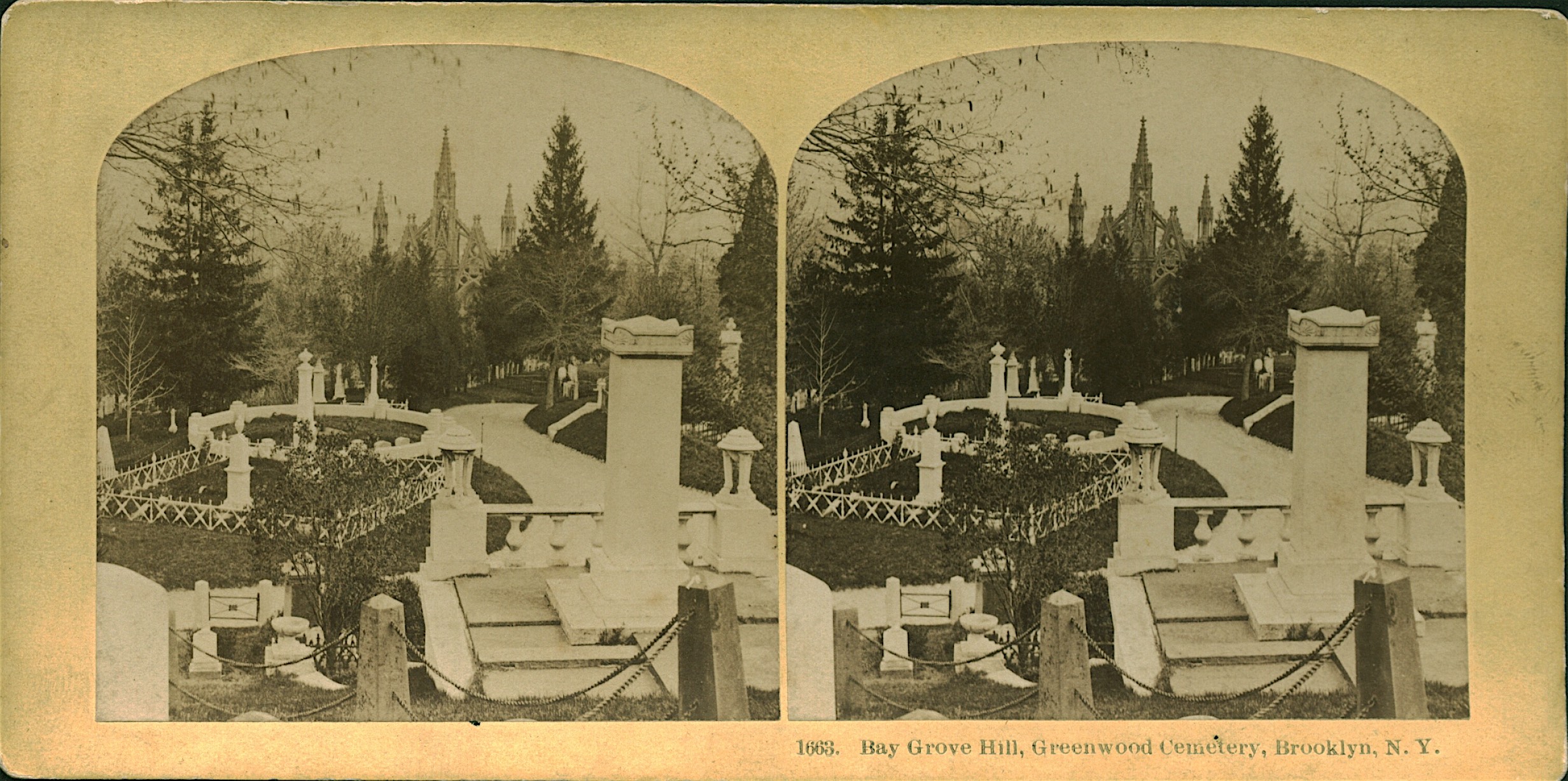
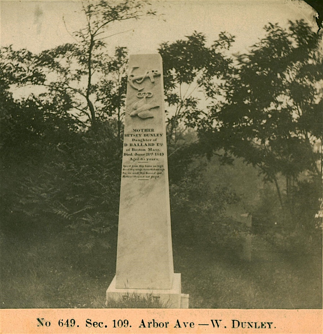
Just some background. In the early 1980s, I began collecting stereoviews–those side-by-side photographs on card stock that, when looked at through a special viewer appear to be in 3D–of New York City. I kept coming across views of some place called “Green-Wood Cemetery”–and, because those views were inexpensive and nicely photographed, and I had long been fascinated by cemeteries, I started to collect them also. Here’s an example:
Over the years I have amassed a collection of almost one thousand views of Green-Wood’s grounds–dating primarily from about 1860 to 1900–that are now a part of the Green-Wood Historic Fund Collections.
Over the years, I, like many others, have been fascinated by “then and now” books. Here’s what the northwest corner of 34th Street and Fifth Avenue looked like in 1870; here’s what it looks like today. But there was always a problem with such books, particularly of Manhattan: typically, nothing had survived from the “then” photograph. That is not the case at Green-Wood–which makes our “then and now” pairs all the more fascinating. Certainly some monuments and mausolea at Green-Wood have not survived over a century and a half of exposure, but, remarkably, much is unchanged. Scenes from 1860 are recognizable in 2017. A photograph taken in 1870 may have an urn, a cross, an obelisk, and more, that survive today. How about the bed of that road–has it moved at all? Is this the right spot? Does that monument, photographed in 1872, still stand? How does it look today in comparison to how it looked then? How have the plantings changed? Fewer weeping willows? More pines back then? What has acid rain done to those marble carvings?
Here are a few then and now images of Green-Wood:
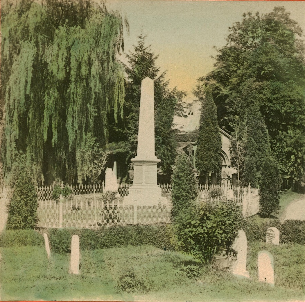
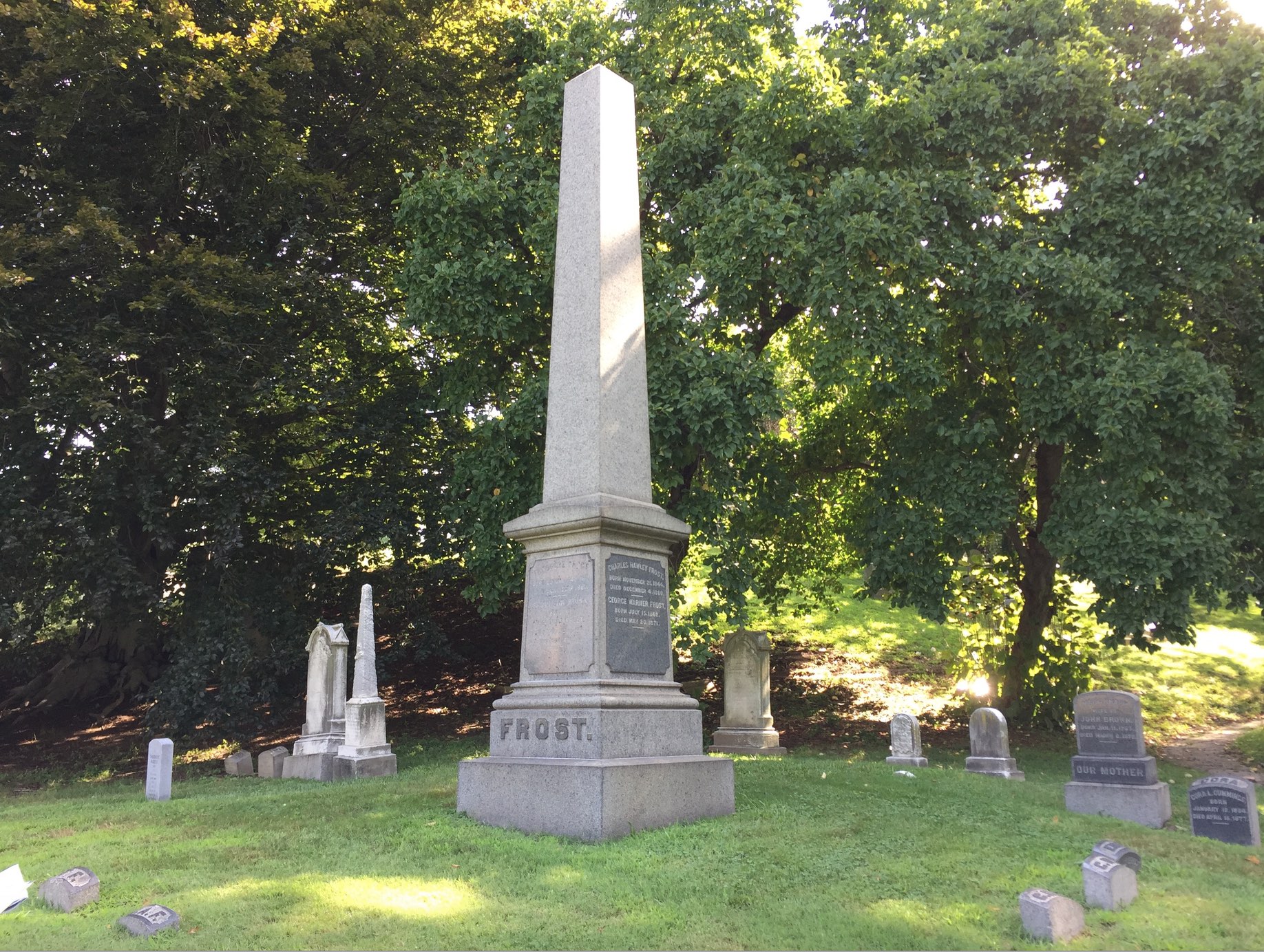
And here’s another rich example:
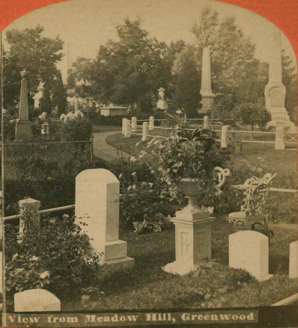
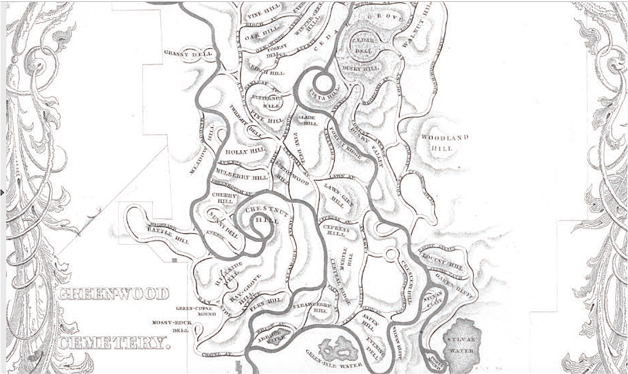
So, I checked early Green-Wood maps for a place called Meadow Hill. Here’s the detail of a map, dating from the 1846 edition of Green-Wood’s first history:
And here is the same location, today:
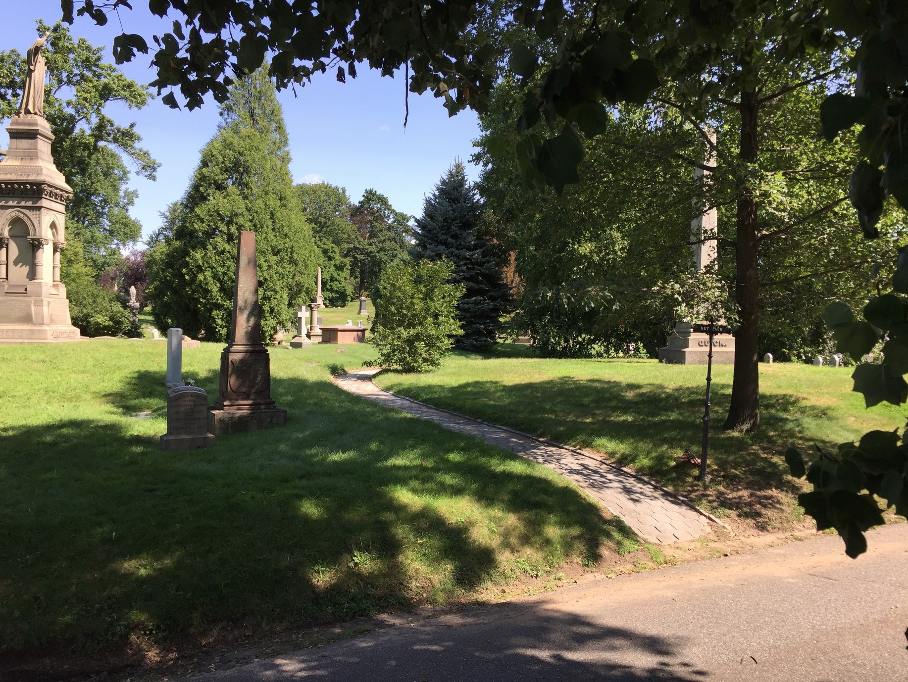
What is remarkable here is that–though the images appear, upon quick examination, to be quite different, Nut Path is just where it should be, and so many of the monuments in the early photo survive. The obelisk at right is still there. The shorter obelisk at left has lost the urn that topped it, but is still there. And, looking closely, you can see in the old image a cross just to the left of Nut Path (where it turns to the right), a low pink granite monument just to the right of that cross, and even (with magnification) an urn in the left distance (painted white in the early photo; painted black today and behind trees from this viewpoint).
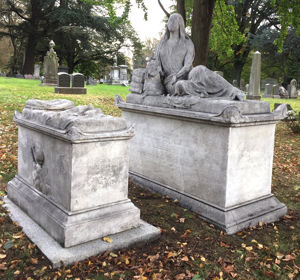
Here’s a good example of how marble, a favorite material of sculptors because it was soft enough to carve easily, has deteriorated over time:

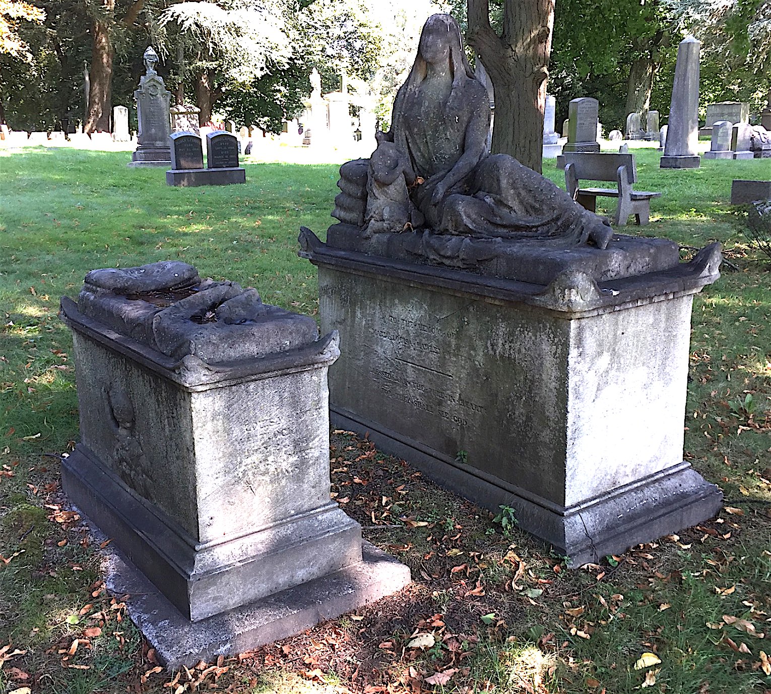
When I saw this view, I thought I might know where it was–perhaps in section 102. So I went out to the lot I had in mind–but the somewhat-similar monument I saw was not the right one. While I was there, I looked off into the distance–and there were the monuments I was looking for, right along Central Avenue, where sections 102 and 96 meet. And here they are today:
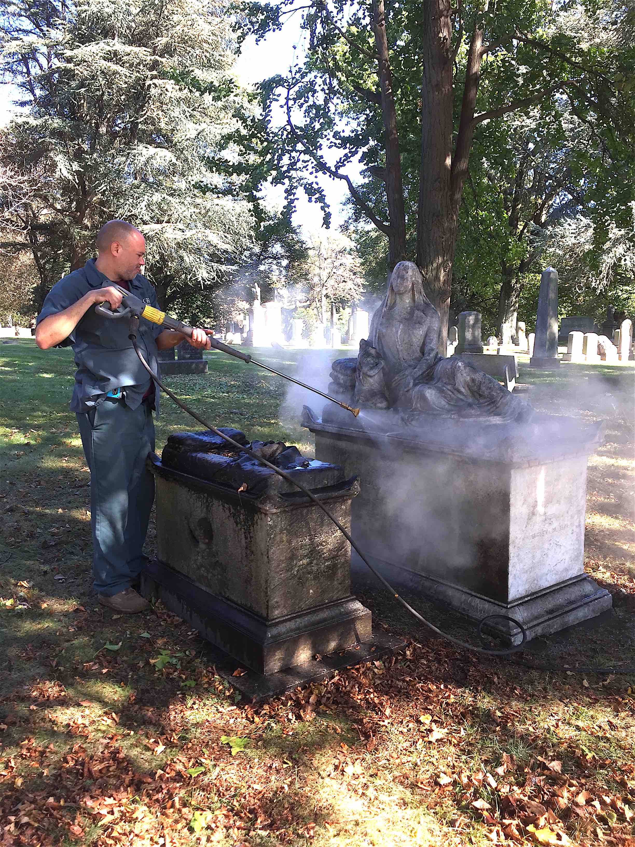
Update: This blog post went up on Thursday, October 19. The next day I e-mailed Neela Wickremesinghe, Green-Wood’s fulltime Manager of Restoration and Preservation. I called these monuments to her attention and asking if she might be able to use Green-Wood’s new cutting-edge cleaning machine on them when she had some free time (and, as you can imagine, Neela is dealing with quite a queue of mausolea and monuments to be repaired and/or cleaned, and has little “free time”). Well, I must say I was shocked when Neela got back to me just a few hours later, informing me that she had put her Restoration Team–Gustavo Padilla and Felix Hernandez–to work on this. Here’s the cleaning in progress:
And here are the cleaned monuments:
And while they were there, they also cleaned several nearby marble monuments. Mission accomplished!
Some of the images in our collections were pretty easy to locate. Here’s one:
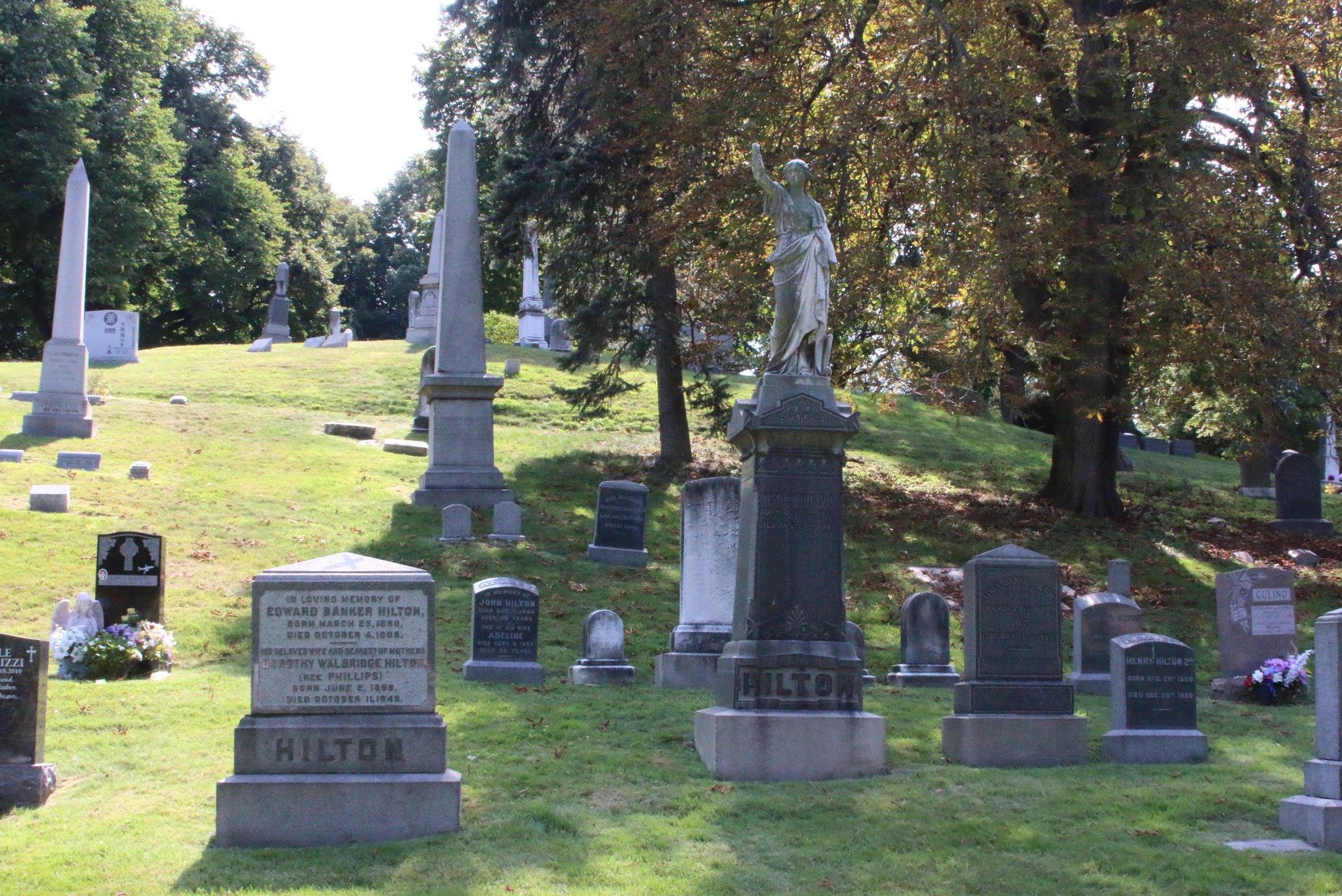
Here’s one of my favorite old views of Green-Wood:

These are the men who maintained the grounds, gathered for a photograph, holding their tools, with what looks like a supervisor, in dark suit, seated on the fence (second man from right). I had long assumed that this photograph, given the hill in the background, had been taken along the last of the hills of the terminal moraine, perhaps along Cypress Avenue in section 139 or 140. Examining it more closely, with a 10x magnifier, I was able to make out the name on the large marble gravestone behind the man 4th from the left: HILTON. A bit of further research puts this view in section 8, along what is now lot 44609 (but back 150 years ago was a road). Here’s today’s view of the same spot:
Some of these historic images posed real challenges in finding their locations. Here’s a particularly interesting example:
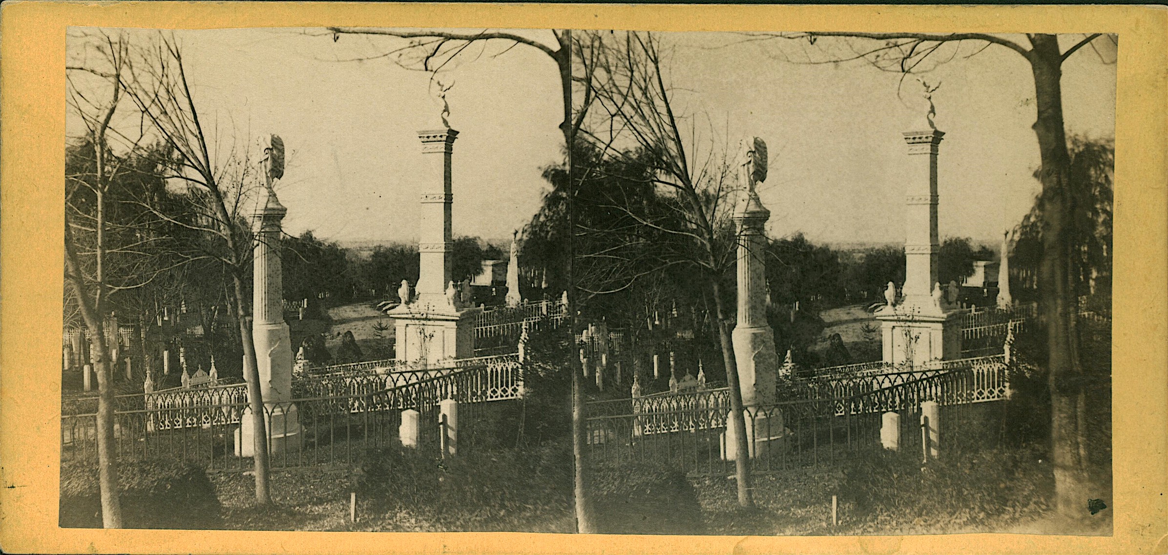
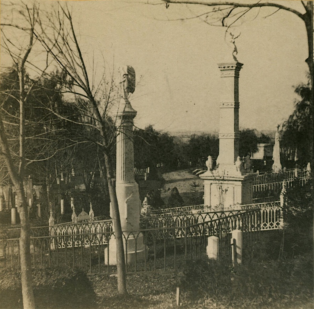
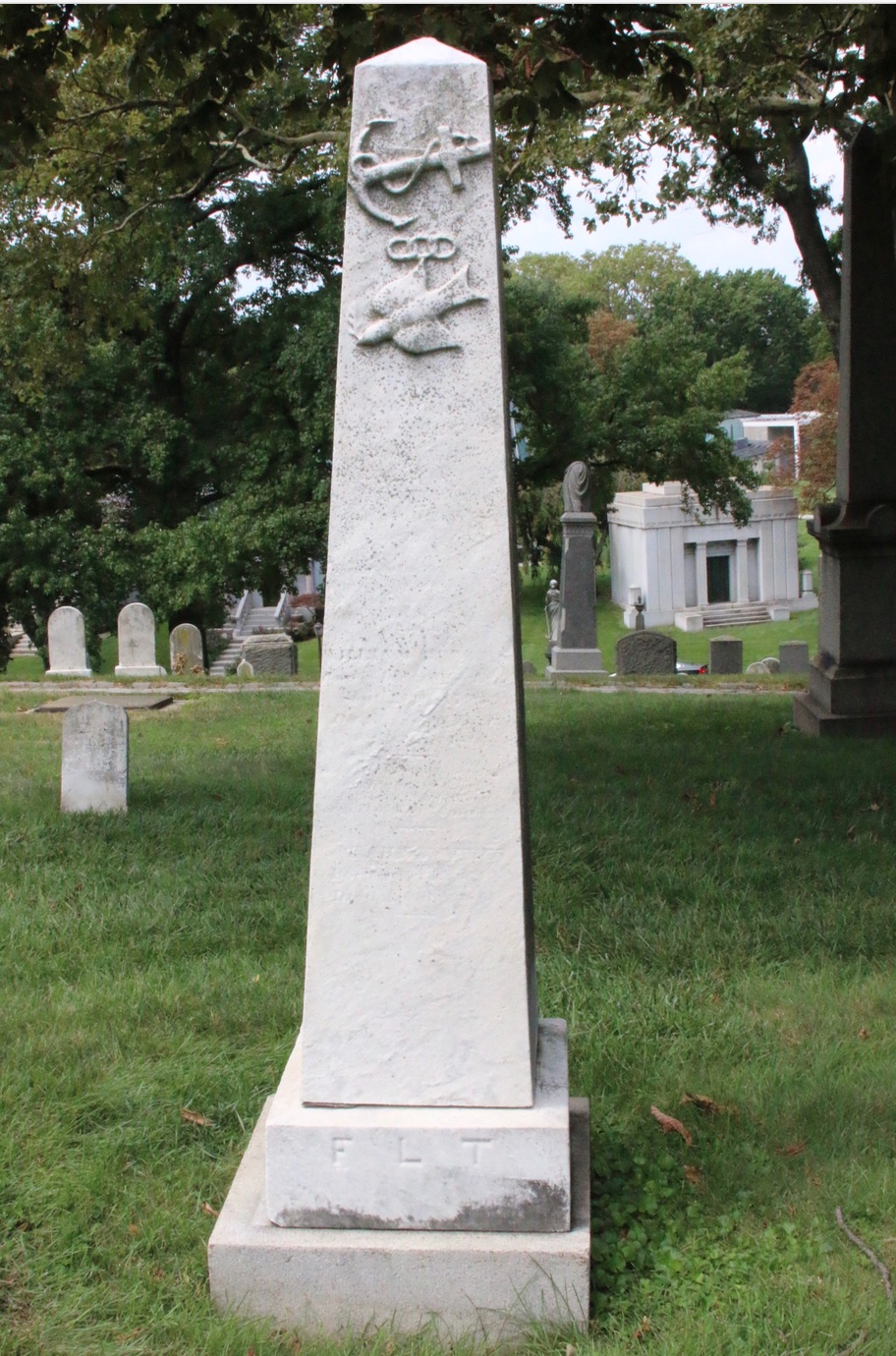
Now, looking at this image, I thought I recognized the Green-Wood’s Fireman’s Monument as the large monument at the right, topped by a figure that I thought was a fireman. So I went out to where the Fireman’s Monument is located and that seemed to be a match. There were the three decorative bands on the shaft; there was the figure of a fireman, atop the monument, pointing into the distance. Here’s the Fireman’s Monument, in a photograph that I took as I tried to solve the mystery of exactly where this view, circa 1865, had been taken:

The next step was to find the large monument at the left side of the old image–the one topped by a shrouded urn. So I walked around the area near the Fireman’s Monument, and there it was!
Now, if you look carefully at the old half-stereoview above, you will see that there is a mausoleum in the right distance. So I walked up past the Fireman’s Monument–and there was indeed a mausoleum in the distance.
But there were still a few problems. Something didn’t seem quite right. There is one hard and fast rule for determining the location of old photographs: if one thing is wrong, then you are in the wrong place. First of all, I had assumed that the two large monuments in the stereoview appeared to be closer together than they seemed when I was out on the grounds because a telephoto lens had likely been used in the early photograph and it had compressed the distance, fooling the eye. But, as I looked again, the monument at left seemed to be turned in a way that was not possible if indeed that was the Fireman’s Monument in that photo. Then it dawned on me: what about that road in the stereoview? There was no such road to the left of the Fireman’s Monument. Had the road been removed? I thought that was unlikely. I considered this matter for a few days, then realized that that monument with the figure atop it was not the Fireman’s Monument at all. Examination of the old photograph with a magnifier revealed that the figure atop the monument was not a fireman pointing; rather, what appeared to be an arm was in fact a tree branch. Standing behind the monument that appears at the left of the old image–the one with the shrouded urn on its top–I realized there was a monument to its right that looked very similar to the Fireman’s Monument. There it was! And there was Spruce Avenue–running and curving just as it had circa 1865 (you can see Spruce Avenue between the two large monuments in the half-stereoview). And, I knew, in the distance down Spruce Avenue, at its intersection with Tulip Avenue (but now hidden from view by a tree) was the Delaplaine Mausoleum that is seen in the distance in the stereoview–and still stands there today.
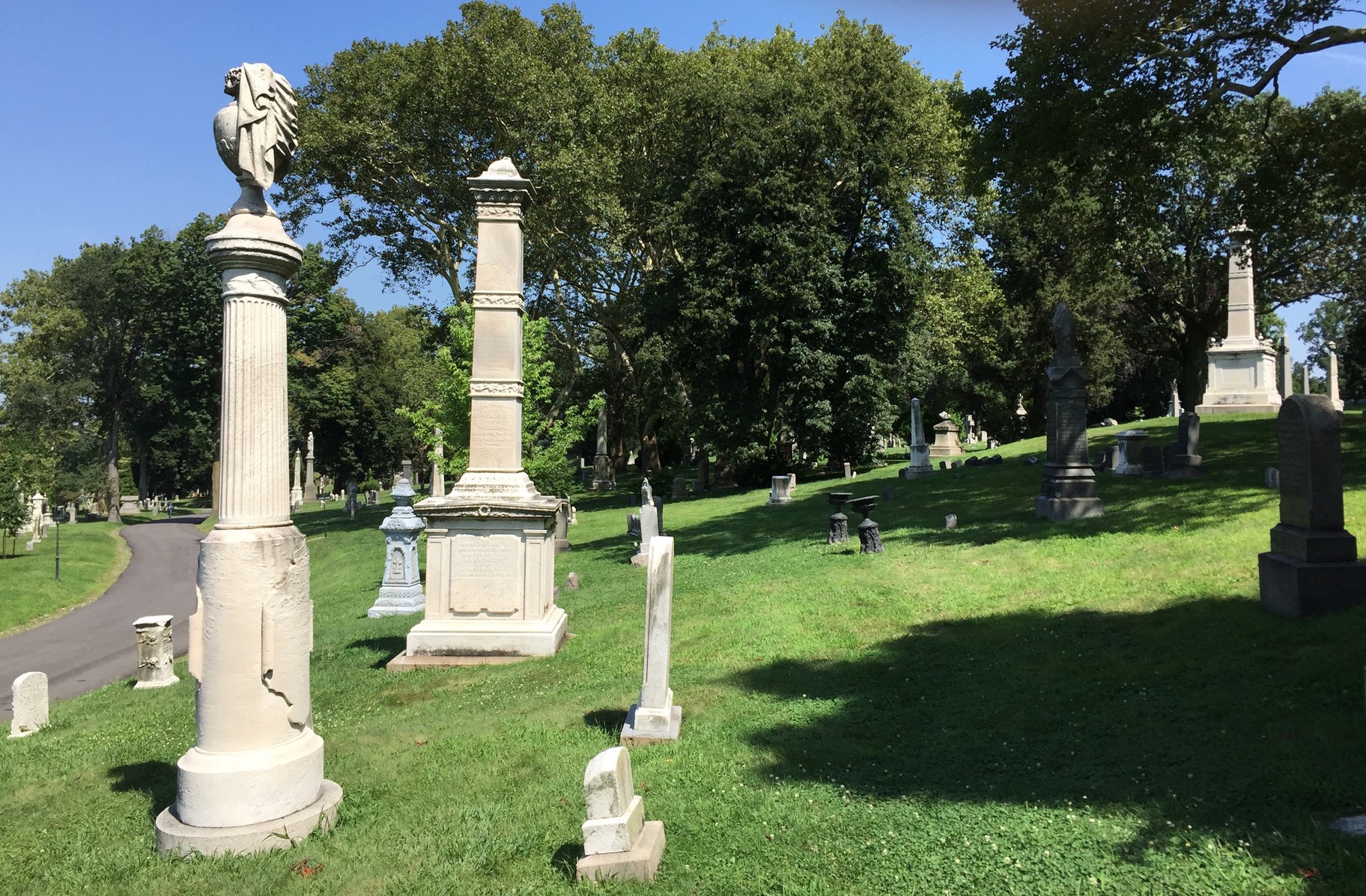
Looking closely, I realized I still had a problem. Look again at the half-stereoview–notice that there are urns atop the base of the second large monument from the left (the one on which a figure stood) on each of its corners. But, as you will see above, those urns are not there today. Was I wrong about the location? Well, I walked over to the monument and saw this on one of its corners where the urns should have been:
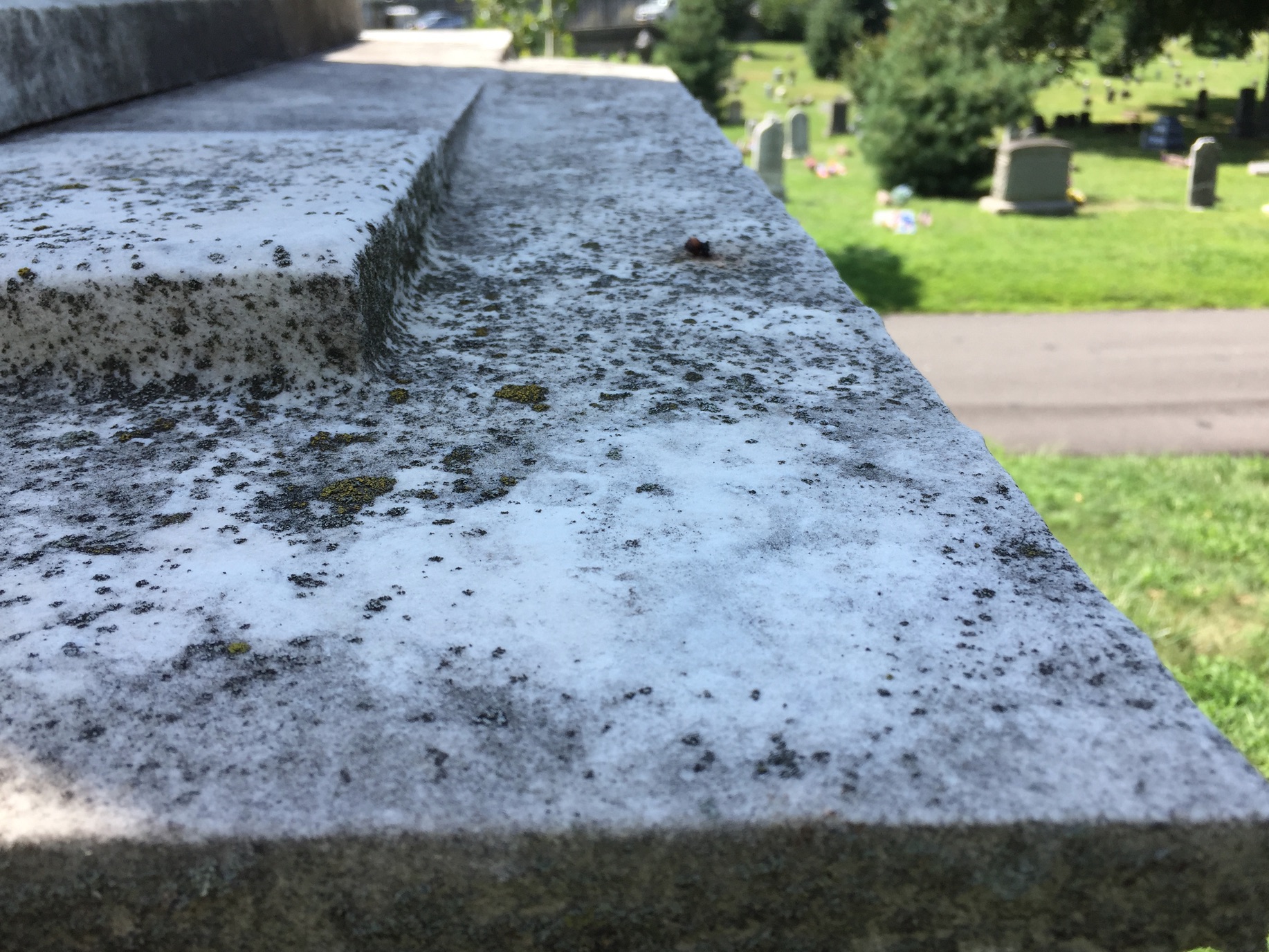
So, all the mysteries of this view were solved. The location of the photograph, taken just over 150 years ago, is set: near the intersection of Spruce and Orchard Avenues, in section 2. Much of what appears in the old photograph is still there, 150 years later!
Several hundred views of Green-Wood should be up on Urban Archive in the next few weeks. We plan to add street views of Manhattan and Brooklyn from our collections to the app soon–those will allow you to walk New York City’s streets and see images of the Jerome Mansion (the home of the grandparents of Winston Churchill), Claflin’s Warehouse, the Roosevelt Family home, and much more, all of which have ties to Green-Wood. Get ready to explore Green-Wood and the streets of New York!
* * *
Thanks to Jim Lambert, volunteer extraordinaire, for his great work on this.
Another Great Blog Two Thumbs up.